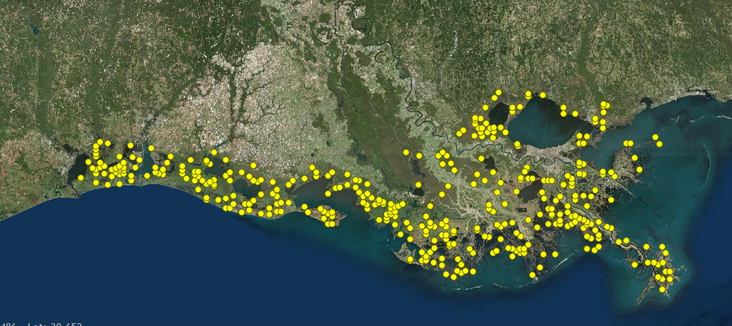
Now I would like to talk more about the CRMS, what it is and does. In 1990 the U.S. Congress enacted the Coastal Wetlands Planning, Protection and Restoration Act (CWPPRA) in order to identity, prepare, and fund construction of coastal wetlands restoration projects. This act brought many plans for restoration projects all of different size and types (planting vegetation to diverting rivers.) Since this was a federal act, ecological success needed to be monitored. They would try to compare project sites to reference sites. Reference sites area areas not part or influenced by project sites. These reference sites were difficult to find since the CWPPRA had such a multitude of projects across the coast so most areas were influenced by current projects. The solution to this problem was CRMS. CRMS was a more comprehensive look of ecological condition of the coastal wetlands. The purpose of CRMS is: to improve our ability to determine the effectiveness of individual coastal restoration projects, provide information to evaluate coastal wetlands at the project, basin, and coastwide scales, and to determine the ecological condition of coastal wetlands to ensure that the strategic coastal planning for Louisiana (Coast 2050, LCA, Louisiana Master Plan) is effective in recreating a sustainable coastal ecosystem. CRMS monitoring data includes: water level, salinity, sediment accretion, surface elevation change, composition and abundance of vegetation, ratio of land to water, and soil characteristics. CRMS approach is to take information from a suite of sites that provides a variety of ecological conditions across the coast. A reference site will be an area where restoration was done and was successful and this areas will be compared to an area similar but needs restoration in which would be the project site. Similar restoration plans would be used to save the project site. CRMS is a state project in which USGS is the federal partner. It is funded $11 million a year from the Sport Fish Restoration and Boating Safety Trust Fund (taxes from fishing equipment, small engine, and motorboat fuel.) CRMS has 390 sites, 45 run by USGS and all others by contractors.
No comments:
Post a Comment